How to Read a Map Scale Bar Without Misjudging Distance
Learn how to read a map scale bar, compare ground distances and avoid confusing a map’s printed size with the distance it represents.
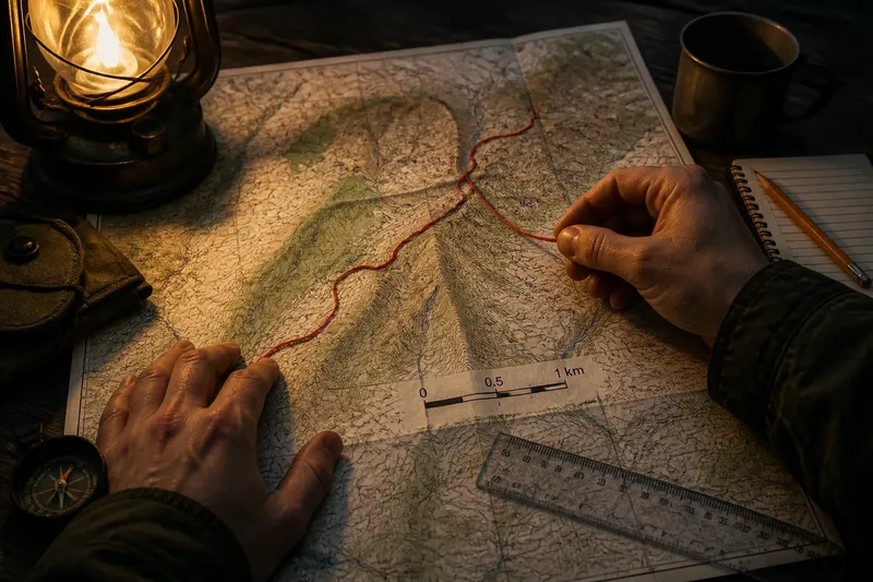
The common mistake with a map scale bar is measuring it once, then assuming it will stay the same length on every copy. That confuses the printed map’s size with its scale and can leave a route looking shorter or longer than it is. A scale bar is useful precisely because it can be checked against the map as it appears in front of you.
Read the bar first
A scale bar pairs a line on the map with a stated ground distance. If the bar is labelled 0 to 1 kilometre, its full drawn length represents that kilometre, whatever length it happens to be on the page or screen.
Many bars are divided into smaller intervals. A bar marked in kilometres might include half-kilometre divisions; one marked in miles might show fractions of a mile. Read the labels and subdivisions before measuring. A line without readable units is not much of a scale bar.
The marked zero matters. On a bar with a short subdivision to the left of zero, the small part can help read a distance that falls between the larger divisions. Measure from zero, not from the left edge of the whole graphic, unless the labels make clear that the bar starts at zero.
Measure the map shown
For a straight-line comparison, use a ruler to measure the route on the map, then compare that length with the scale bar. The units need not be converted if both measurements use the same ruler units: a route twice as long as the bar represents twice its labelled ground distance.
For a winding line, use a strip of paper or a piece of non-stretch thread. Mark the start, follow the route in short sections, and transfer the resulting length to the bar. A ruler alone tends to turn bends into an optimistic straight line.
Say you have a printed map whose scale bar represents one kilometre and measures five centimetres on the paper. An imagined path measures seven and a half centimetres by the same method. It corresponds to about one and a half kilometres on the ground, before allowing for the fact that a map route may not follow every bend in a real path.
Why print size misleads
A map’s stated ratio, such as 1:25,000, means that one unit measured on the original map represents 25,000 of the same units on the ground. The ratio depends on the map’s dimensions as published, not on the size of the sheet or screen currently showing it. Enlarge the map and the ratio no longer describes the displayed dimensions.
A scale bar behaves differently in this respect. If a whole map image is enlarged or reduced proportionally, its bar changes with it. Measuring the bar on that same image preserves the comparison. Measuring a route against a memorised ruler length for the original bar does not.
This distinction is handy for a photocopy, a resized PDF or a map embedded in a web page. If the bar is visible and legible, compare distances with the bar as displayed. If it has been cropped out, stretched independently, or blurred beyond reading, the image may no longer support a dependable measurement.
Scale bar questions?
Can I use a scale bar on a phone?
Yes, if the bar and the map are displayed at the same zoom and the image has not been distorted. Compare the route and bar on screen, or use a screen-measuring tool that applies equally to both; do not transfer a paper ruler measurement from another display size.
What if the map has no scale bar?
Look for a printed ratio or a stated scale, but use it only if you know the map has not been resized. If neither a usable bar nor reliable scale information is present, treat measured distances as rough visual estimates rather than precise comparisons.
Does a scale bar give walking distance?
It gives distance represented by the map, usually the map distance between two points, not the exact length of a walk. Turns, path alignment, bridges, barriers and route choices can make the distance travelled differ from a straight-line measurement.
Why do two maps show different distances?
They may measure different lines, use different levels of detail, or represent the route differently. Check that you are comparing the same start and end points and the same kind of distance before treating the difference as a disagreement.
Choose the right comparison
A straight ruler measurement answers a narrow question: how far apart are these two points on the map? To estimate the length of a mapped road, river or path, trace its course instead. To compare several candidate routes, use the same method for each and note whether you are comparing map distance or a route that can actually be travelled.
Small measuring differences are normal. A thick printed line has width, and the precise point at which a bend begins may be unclear. For a general comparison, that uncertainty may not matter. For a decision that depends on exact distance, use a map or navigation source suited to that task rather than pretending the printed line is more precise than it is.
It is not worth recalculating a ratio from the page dimensions when a readable scale bar is already present. The calculation adds work while making the result more vulnerable to resizing. A ruler, the visible bar and a clear choice between straight-line and traced distance are usually enough.
Keep the units visible
Scale bars may use kilometres, metres, miles or another unit. Keep the unit attached to the result as you compare distances; a number without its unit is an unfinished measurement. If converting units is necessary, do it after measuring and check the conversion with a reliable reference rather than relying on a remembered figure.
When sharing a result, say how it was obtained: for example, “about one and a half kilometres by the mapped path” or “roughly two kilometres straight-line”. That wording makes the scale-bar comparison clear and prevents a map distance from quietly turning into a promise about the ground.
For a quick check, measure the bar itself on the copy or screen you are using, then compare the route with it. That simple habit is the point of a scale bar: the map can change size, while the comparison remains available in plain view.