Ridge, Spur or Valley: Reading the Lines on a Topographic Map
Read ridge, spur and valley patterns on a topographic map to identify rising and falling ground, choose a sensible interpretation and avoid contour-line misreads.
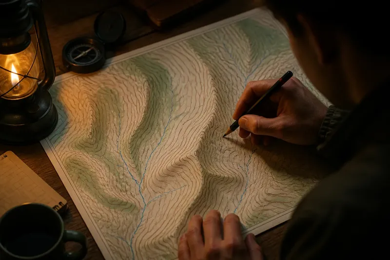
The common mistake with ridge, spur and valley patterns on a topographic map is to treat every contour bend as the same kind of feature. The cost is a mistaken picture of where the ground rises and falls. Check the elevations as well as the bend: a valley’s contour V points uphill, while a ridge or spur has high ground along its axis.
Contour lines join places at the same elevation. A ridge is an elongated area of high ground with slopes falling away on either side; a spur is a narrower projection of high ground from a ridge or hillside. A valley is a low channel between rising sides. Their contours may all curve, but their relationship to higher and lower ground differs.
Read contour lines
Start with the contour labels. Adjacent lines represent successive rises or falls, but the interval varies between maps. If only some lines are labelled, trace a labelled line and count the intervening contours cautiously; do not assume another map uses the same interval.
Close contours generally indicate a steeper slope, while wider spacing generally indicates a gentler one. Spacing does not name the landform: a steep valley side and a steep ridge side can look much the same. The direction of the bends, read against the elevations, supplies the distinction.
Imagine a set of nested contour bends with their V tips facing higher labelled elevations. That pattern indicates a valley, whose low axis runs downhill in the opposite direction. If high ground instead follows an elongated axis and falls away on both sides, the feature is a ridge or spur.
Trace ridge and spur
On a ridge or spur, high ground follows the feature’s axis and falls towards lower ground on either side. A ridge is the broader, more continuous crest. A spur is a narrower finger of high ground that projects from a ridge or hillside, often between drainage lines.
Do not confuse the ridge’s axis with a valley’s contour V. The axis of a ridge or spur runs along high ground; the pointed ends of the surrounding contour Vs generally face downhill. In a valley, by contrast, the contour V tips face uphill, towards higher elevations, while the low valley floor runs downhill.
Look at the surrounding contours to distinguish scale and connection. A long high crest with slopes descending on both sides is a ridge. A smaller, narrower branch attached to that high ground, with lower ground on either side, is a spur. A spur can belong to a ridge system rather than being a separate competing feature.
Recognise valley bends
A valley is a low channel with higher ground rising away from its floor. Where contours cross it, their V-shaped bends point upstream, towards higher elevations. The valley itself runs downhill in the opposite direction.
A broad valley may have a gently sloping floor and steeper sides; a narrow one may show tight contours on both sides of a sharp bend. In either case, look for the low axis and repeated uphill-facing contour Vs rather than relying on how dramatic a single bend appears.
Not every low area is a valley. Closed contours with lower values towards the centre can mark a depression, while a broad low area may be a basin. Check for an extending drainage axis, compare the elevation labels and consult the map legend for depression symbols before settling on a reading.
Choose from the pattern
When one bend is unclear, trace neighbouring contours, compare their elevations and check which pattern continues across the area. Use each observation to make a specific decision:
- Observation: A labelled contour near the bend rises towards its V tip. Decision: If neighbouring contours also point uphill there, read the feature as a valley; otherwise, trace more contours before naming it.
- Observation: A long crest has lower ground on both sides. Decision: If the high ground continues along the area, call it a ridge; if it narrows into a branch, consider a spur instead.
- Observation: A narrow high finger lies between lower channels and connects to a larger slope or crest. Decision: If those relationships are clear, read it as a spur; if the connection is unclear, use the broader term ridge or hillside.
- Observation: A low channel has rising ground on both sides. Decision: If repeated contour Vs point towards higher elevations along the channel, read it as a valley; if not, check for a basin or another low area.
- Observation: Contours close into a loop with no clear outlet. Decision: If the labels rise towards the centre, consider a summit; if they fall towards it, consider a depression and check the map symbols.
- Observation: Contours are widely spaced around a bend and the feature’s axis is hard to follow. Decision: If neighbouring lines still show a consistent high or low axis, name that larger feature; otherwise, leave the small bend unnamed.
Say you have a map with a labelled contour near a narrow bend, two lower drainage lines and a higher crest behind the bend. You trace the neighbouring contours and see that their tips face the higher labelled ground. Then you check the elevations and find that the narrow strip between the drainage lines is higher than both sides and connects to the crest. The bend is part of a spur, not a valley: the high finger projects from the crest, while a valley reading would require a low channel with contour Vs pointing uphill.
Resolve unclear bends?
Which way does a valley V point?
Its tip generally faces uphill, towards higher ground. The valley’s low axis runs downhill in the opposite direction.
Which way do ridge contours point?
The contour Vs around a ridge or spur generally point downhill, away from the high axis. The axis itself follows the elongated high ground rather than the V tips.
Can a spur be part of a ridge?
Yes. A spur is a narrower projection from a larger ridge or hillside. The terms describe connected forms at different scales.
What if the contours make no clear V?
Compare several neighbouring lines, their labels and the overall arrangement of high and low ground. Rounded terrain can produce shallow bends, so one contour rarely settles the reading.
Use the map legend
When the pattern remains uncertain, start from a known elevation, such as a spot height or labelled contour, and trace the surrounding lines. Ask whether the centre of the feature is high or low, then check whether a narrow branch leads away from a larger high area.
Index contours are often drawn more heavily or labelled more clearly, so they can be easier to follow through a complicated patch. Spot heights help locate a summit or local high point, but a single point does not show the full shape of the slope.
It is not worth assigning a precise name to every tiny wrinkle. Small features may be simplified at the map’s scale, and some bends have no useful separate label. Read the larger landform first; call a feature a spur only when its connection to higher ground and its lower sides are clear.
For ridge, spur and valley patterns on a topographic map, keep the distinction between the contour bend and the landform’s axis in view. A valley’s contour V points uphill; a ridge or spur carries high ground along its axis, with surrounding contour Vs generally pointing downhill. When a single line is ambiguous, neighbouring contours and elevation labels provide the better reading.
Check the particular sheet’s legend and contour interval, especially around depressions or simplified terrain. The labels establish which way is uphill; the surrounding pattern tells you whether that rising ground forms a crest, a projecting spur or the sides of a valley.